

Wansfell [Baystones]
Good walks are even better shared.
NY4005 : On Baystones
Michael Graham Photo source
Overview
Wansfell [Baystones]
Overview
Wansfell, nestled in the heart of the Lake District, offers a delightful escape into nature, complete with stunning views and a variety of routes. At an elevation of 481 meters, it’s a Marilyn, which basically means it's modestly prominent but can still give you a good workout.
Geology
Wansfell’s impressive landscape is largely shaped by volcanic tuff, creating a unique geology that makes exploring the area a treat for both the eyes and the mind. Glacial activity has further sculpted its vistas, leaving delightful shapes and hollows that could inspire a few poets!
Routes
Two popular paths lead to the summit:
Wansfell Pike from Windermere
- Distance: 4.5 km
- Time: ~2.5 hours
- Difficulty: Moderate
A lovely route that begins in Windermere, perfect for those who like a scenic woodland stroll before a good heart-pumping climb.
Ambleside Path
- Distance: 3.8 km
- Time: ~2.0 hours
- Difficulty: Easy to Moderate
Starting from Ambleside, this path allows you to take in the beautiful landscape at a leisurely pace, ideal for picnics and snapping photos.
Summit Features
The summit presents a cairn and trig point, not only a great vantage point for the vistas but also an invitation for those incessant selfie-takers among us. Just remember to share with the mountain!
Terrain Type
The terrain features a delightful mixture of grassy slopes, rocky outcrops, and patches of vibrant heather. Hope you wore your rugged boots!
Views
From the top, the scenery is nothing short of exceptional: you can gaze upon Lake Windermere glittering in the sun and explore the expanse of the southern Lakes. The best seasons to capture these stunning landscapes are spring and autumn, when clarity reigns supreme.
Hazards
While Wansfell is accessible, take care; the terrain can often be slippery, especially after rain, and sudden weather changes are common. Keep your eyes peeled and hands ready for stability!
Access
- Nearest Parking: Windermere Ferry terminal or public car parks in Ambleside.
- Public Transport: Regular buses can take you to Ambleside and Windermere from the major towns, ensuring no one is left in the lurch!
- Nearest Town: Ambleside, well-equipped with amenities.
Facilities
Nearby facilities in Ambleside include a range of charming cafes, pubs, and public toilets. Perfect for post-hike recovery!
History
The name 'Wansfell' likely hails from Old Norse origins, adding an intriguing layer to your hike. Historically revered, it offers both cultural significance and adventure to those who traverse its paths.
Conclusion
Wansfell [Baystones] is more than just a hill; it’s a delightful journey that combines natural beauty, accessibility, and a touch of history, perfect for a day out in the stunning Lake District. Pack your walking boots and keep the camera handy for those knock-your-socks-off views!
Explore routes near Wansfell [Baystones]
Walks starting near this hill. Open a route to check its map, distance and full itinerary.
Tarn Hows Fast Route
View route
Coniston to Tarn Hows: Monk Coniston Gardens and Woodland Circuit
View route
Bow Fell from Langdale
View route
Striding Edge, Helvellyn and Catstye Cam
View route
Route planning notes
These notes describe possible approaches. Check a route's map and access information when planning your walk.
Wansfell Pike from Windermere
A popular route starting from Windermere, winding through woodland before a steep ascent to the summit.
Ambleside Path
This route begins in Ambleside and offers a gradual ascent through picturesque valleys and fields.
Make a day of it, together
Find someone to share the walk with, or organise a day out along a route you like.
Photo Gallery
View all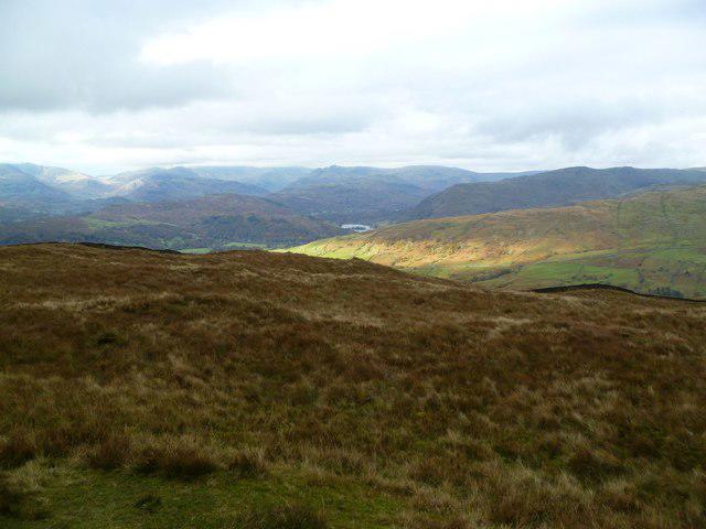 Photo could not load
NY4005 : On Baystones
Michael Graham
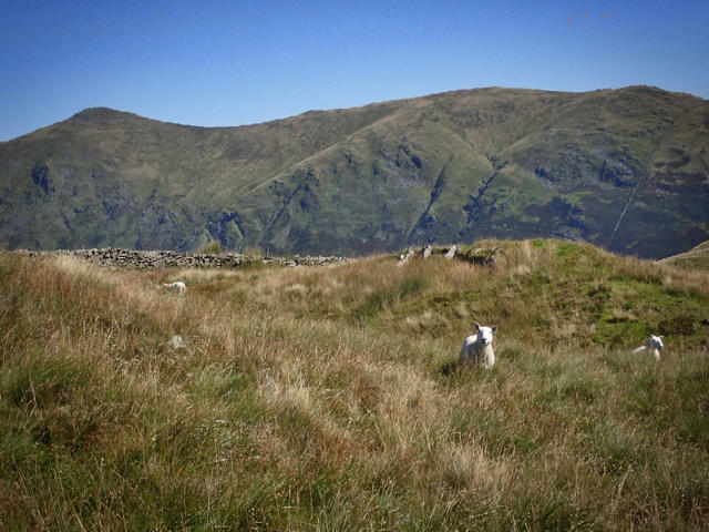 Photo could not load
NY4005 : On Baystones
Mick Garratt
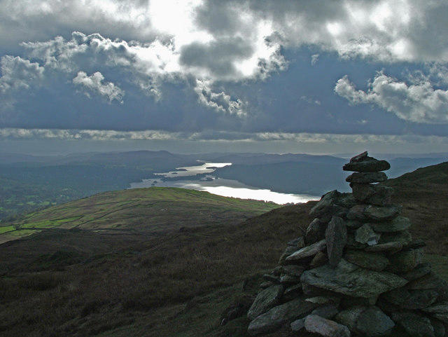 Photo could not load
NY4005 : Windermere from Baystones summit
Roger Leighton
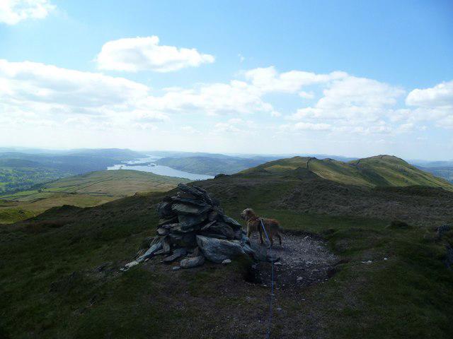 Photo could not load
NY4005 : On Wansfell
Michael Graham
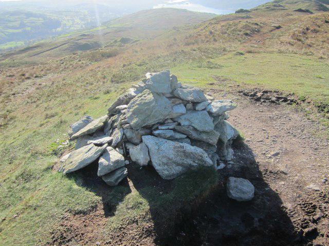 Photo could not load
NY4005 : Cairn on Baystones
Graham Robson
![NY4005 : Baystones [Wansfell]](https://cdn.walkmates.com/gallery-images/af6b527934684d0fa79112567e0014ae.jpg) Photo could not load
Photo could not load
NY4005 : Baystones [Wansfell]
Rude Health
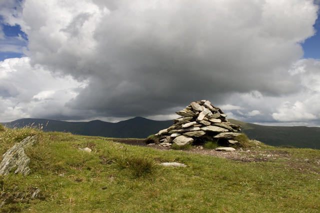 Photo could not load
NY4005 : Cairn Wansfell summit
Tom Richardson
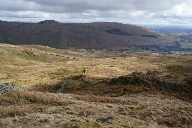 Photo could not load
NY4005 : The east side of Baystones
Bill Boaden
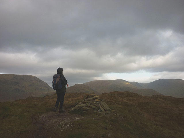 Photo could not load
NY4005 : The top of Wansfell (Baystones)
Karl and Ali
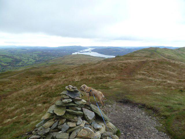
NY4005 : On Baystones [Wansfell]
Michael Graham
Hill facts and local notes
Classifications
Elevation
486m
1,595 ft
Prominence
6m
Coordinates
54.4394, -2.9211
NY403052
OS Map
90
Explorer: OL7N
At the Summit
The summit features a prominent cairn and a trig point, offering a perfect photo opportunity—if you can squeeze through the selfie sticks.
Terrain & Geology
The dominant rock type is volcanic tuff, shaped by glacial activity which has resulted in the smooth contours of the landscape surrounding the mountain.
Views & Scenery
The stunning vistas of Lake Windermere, the rolling hills of the southern Lake District, and on a clear day, even the distant peaks of the Langdale Pikes.
History & Heritage
Name Origin
The name 'Wansfell' is believed to derive from Old Norse, with 'fell' meaning mountain and 'Wans' possibly linking to a Viking deity.
Historical Significance
Wansfell is significant not only for its natural beauty but has also been popular with hikers and adventure enthusiasts for generations, often celebrated in local literature.
Getting There & Facilities
Parking
The nearest parking is at the Windermere Ferry terminal (approx. NY395021) with a small fee, or alternative parking in Ambleside.
Public Transport
Buses run frequently from major towns to Ambleside and Windermere, with National Rail services to Windermere station.
Nearby Facilities
Ambleside offers numerous cafes, pubs, and public toilets for a hearty meal or a quick pit stop.
Safety Information
Known Hazards
- The terrain can be slippery, particularly in rainy conditions. Watch out for sudden weather changes, and be wary of craggy edges.
General Safety Tips
- Check weather conditions before setting out
- Carry appropriate clothing and equipment
- Let someone know your planned route
- Take a map, compass, and GPS device
- Carry emergency supplies: food, water, first aid kit, torch
Hills
Some common questions about the hills answered
Are there group walks up Wansfell [Baystones]?
Many walkers use Walkmates to join or organise walks with others. You can check for group walks around Wansfell [Baystones] through the maps
Are there other walkers around Wansfell [Baystones]?
Activity varies by location and time, but Walkmates lets you see whether others have shared walks or shown interest in this area. Find other people through the walking friends search walking friends for Wansfell [Baystones] search or of course create your own walk for Wansfell [Baystones]
Can I organise a walk to Wansfell [Baystones]?
Yes. If there aren’t any walks listed already, you can create a walk and make it available for others to join.
If you're signed up to Walkmates, you can create a walk to Wansfell [Baystones].
How do I find a walk up this hill?
There are often multiple ways to walk this hill, depending on experience and route preference. Walkmates helps you explore walks and routes that others have shared.
Can I suggest a new route up Wansfell [Baystones]?
Yes. You can suggest or create routes to share with others. Walkmates focuses on the social side of walking, so routes are used to help people organise walks and explore areas together, rather than as detailed navigation tools or route libraries.
Other uses really appreciate knowledgeable walkers sharing their routes. Share your favourite route to Wansfell [Baystones] here
The is an error or something incorrect about this hill. How do I let you know?
We always strive to keep the information on Walkmates as accurate as possible. If you find an error, please let us know through the contact form and we'll aim to correct it as quickly as possible
Community Discussion
Comments
Location
![Wansfell [Baystones] location map](https://cdn.walkmates.com/hill-maps/hill-sources/3838/54.43938_-2.92113.png)
Grid reference: NY403052
View on OpenStreetMapOpens a map in a new tab, centred on the hill.

No comments yet. Be the first.